Comment on the City’s 24th-34th Shoal Creek Trail Gap Proposal
August 16, 2023 | By Shoal Creek Conservancy
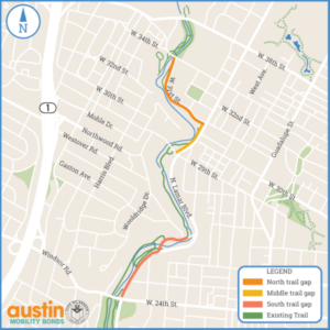
The City of Austin Transportation and Public Works Department is gathering public input through October 8, 2023 (extended deadline) on a proposed project to fill the main gaps in the Shoal Creek Trail from W 24th to W 34th Streets, in line with the vision set forth in the Shoal Creek Trail Plan. The project objective is to improve trail connectivity, comfort, and safety conditions within three distinct gap segments along this stretch.
Shoal Creek Conservancy recommendations in response to the Trail Gap Proposal (updated 9.29.23):
South Gap: W 24th Street to 2800 Shoal Creek Boulevard
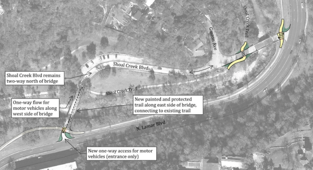
Shoal Creek Conservancy supports the proposed design with some caveats. We appreciate upgrading to a 12-foot wide all ages and abilities shared-use path along N Lamar Boulevard, which is ideal for pedestrian and cyclist comfort and safety, and improving the crossings at N Lamar Blvd and Shoal Creek Boulevard.
While the proposed design in the parking lot area makes good visibility and safe crossing improvements, various stakeholders have expressed concerns about the one-way traffic pattern along Shoal Creek Blvd and the southern entrance to the parking lot. . SCC recommends exploring other safety improvement options that retain a two-way flow of traffic throughout the Shoal Creek Blvd roadway/parking lot. Options for increased safety and visibility on Shoal Creek Blvd could include physical demarcations of shared spaces, striping or texture changes in crosswalks, lights, signage, and other improvements throughout the area that would indicate a multimodal shared space and crosswalks and promote slow and safe speeds.
The curbside trail along North Lamar will serve users as a safe, wide, and comfortable path for commuting and recreation. However, SCC will continue to recommend that the City take action to resolve the landslide to allow for a recreational path along the west side of the creek. These parallel paths would serve users looking for a variety of trail experiences and access to green space in central Austin.
Middle Gap: W 29th Street to W 31st Street
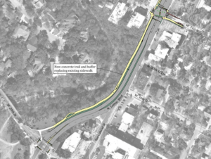
Shoal Creek Conservancy strongly supports this proposed design! We appreciate upgrading the sidewalk along N Lamar Boulevard to a 12-foot wide urban trail from W 29th Street to W 31st Street as an all ages and abilities addition to the Split Rock Canyon nature trail.
North Gap: W 31st Street to W 34th Street
The North Gap follows W 31st Street west to an existing Shoal Creek Trail trailhead where the street name then transitions to Shoal Creek Boulevard north of the trailhead.
The City first launched a public process to address this gap in 2020. After installing a pilot trail in 2021, the project team has been monitoring and adjusting the pilot to identify the best configuration of the street for all its users. This latest proposed design is the fifth iteration.
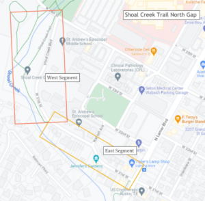
Understanding the unique constraints of this street, the project team has prepared several options to fill the North Gap. The options are divided into two segments: East of the Shoal Creek Trail trailhead and West of the trailhead.
North Gap, East Segment: N Lamar Boulevard to Shoal Creek Trail Trailhead
Shoal Creek Conservancy strongly supports Options 1 or 2, keeping the trail connection on the south side of the street and reducing conflicts with motor vehicles. We appreciate the 10-12 wide trail minimums proposed in Options 1 and 2. We are not in favor of Options 3 and 4 which would introduce potentially dangerous street crossings and interrupt the connectivity of the trail. In order to address some concerns from relevant stakeholders, SCC recommends the consideration of trail features including mountable curbs or a temporary narrowing of the trail at the Wabash Ave intersection that could help resolve these concerns and allow users of all modes to navigate the street safely and comfortably. SCC recommends the consideration of integral colored concrete on this segment of trail as well.
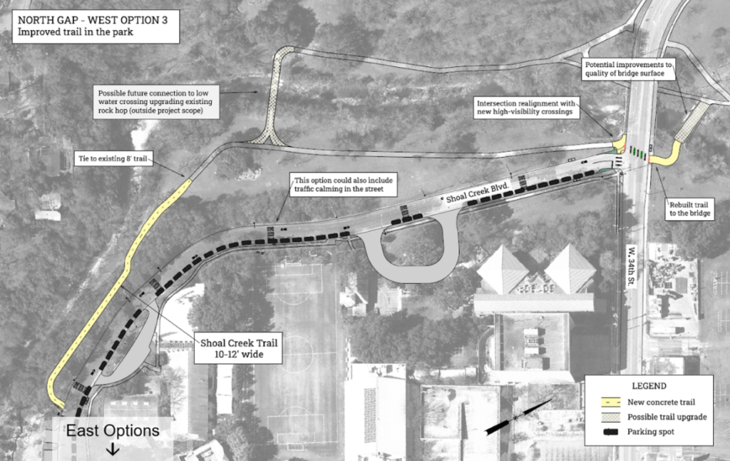
North Gap, West Segment: Shoal Creek Trail Trailhead to W 34th Street
In alignment with the Shoal Creek Trail Plan that advocates for the trail to be in the greenway, Shoal Creek Conservancy recommends Option 3, which offers an improved and ADA accessible trail “in the park.” Options 1 and 2 keep the trail on the south/west side of the street, which would separate trail users from vehicles, but does not align with the vision set forth in the Trail Plan. We are not in favor of Option 4 because it would place trail users and motor vehicles in the same right-of-way.
SCC recommends additional improvement to the width of the trail in the rest of this segment, so that a Urban Trails standard 12’ connects all the way to 34th street. We also support the improved crossing at 34th street to improve the safety and comfort of trail users, as well as the rebuilding and resurfacing of the trail and bridge directly north of 34th street.
Review the Trail Gap Proposal – Interactive Version
Review the Trail Gap Proposal – PDF Version
Email info@shoalcreekconservancy.org if you have questions or comments for SCC.
Thank you for helping to improve the Shoal Creek Trail!
