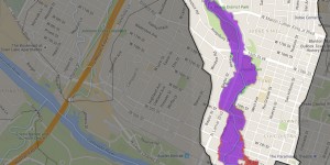
New Shoal Creek Floodplain Mapping Available
June 20, 2015 | By Shoal Creek Conservancy
 Curious to see if your house or business is in Shoal Creek’s 100-year storm floodplain? In the wake of the 2015 Memorial Day Floods, the floodplain map for Shoal Creek has been updated and can be viewed at the City’s all-things-flooding website: www.atxfloods.com. The revised boundaries have been submitted to FEMA for approval, which is expected to occur in July 2015.
Tags
Awards & Recognition
bridges
City + Water
City of Austin
community input
Connectivity
creek
Culture
Earth Science
Ecological Restoration
Education
events
flooding
green infrastructure
headwaters
Health & Wellness
History
Lady Bird Lake
landslide
news
parks & green spaces
Partnership
People
Plants & Animals
points-of-interest
SCC
springs
Staff & Board
stormwater management
support
trail
Trail Improvements
Trail Plan
volunteer
water quality
Watershed Action Plan
